US 50 -- Utah
Copyright 2010 W. Berg Press

Welcome to Utah - The Beehive State.
The capital is Salt Lake City. - State motto is Industry.
It was 1896 when Utah achieved statehood. Out here we can see forever,
as the saying goes. One should have cruise control to maintain speed and to ease driving
fatigue. Along the highway fence we see occasionally, large, black birds, which I expect
are some kind of crow, sitting there waiting for their prey. They don't fly away as the
traffic moves by. They just sit there and look.
Green River is a
must stop for service. The next service is available in 110 miles. The city is famous for
melons and has more days of sunshine than any other place. The Green and Colorado rivers
are the most dominant water resources in the arid west. These rivers drain an area of
about one-seventh of the United States. The corrosive power of the dirt-laden currents
created canyons and gorges ranging up to 3,000 feet vertically in some locations. John
Wesley Powell explored the rivers by traveling in 1869 from Green River, Wyoming.
The next stop in 105 miles is Salina, a distance farther than or equivalent to the
distance from Richmond, Virginia, to Washington, D.C., without service. As we drive down
this lonely road, we pass through canyons; the scenery is miraculous. There are towering
walls that were made to cut out the roadbed. We make numerous stop, intoxicate ourselves
on the scenery and take pictures. Between Green River and Fremont Junction, the swell
exposes geologic formations. Deep canyons, slick rock domes, sandstone cliffs and
flat-topped buttes are all visible from I-70. The rock colors change from bloody red to
rust to green and purples. As we come closer to Fremont Junction, the sandstone is yellow,
an interesting change. It is yellow-white versus the previous red sandstone.
As we travel through Salina Canyon, we see trees again; not big trees, but desert trees.
These are brush types, very rugged vegetation. We drive through the northern part of the
Fishlake National Forest and are climbing up again where snow is in the region. As we come
higher, we look for a sweater and close the windows. Our ears are plugging up and popping.
We can only imagine what driving conditions must be in winter time on these steep hills
with very wide open areas. There are warnings for ice during winter driving conditions.
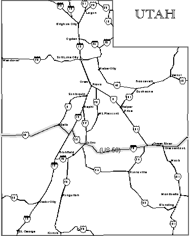
Salina is where we will leave Interstate 40 and continue westward on Route 50. The sky is
getting darker. Salina is in the valley, and on the other side are mountains. Since it's
getting late in the afternoon, we opt to stay in Salina. We are at the crossroad where
I-70, US 50 and US 89 meet, divide and separate. For centuries travelers have stopped here
for the night to rest and then continue their journey early in the morning.
The place is high in the Utah mountains. This is also the place where Chief Black Hawk
made war with white settlers because they could not resolve their differences. Today it is
a peaceful place.
I know we must be in cattle country because when we enter a freeway, such as the
Interstate, we have a cattle guard grill in the roadway. Watch out for free-running
cattle, deer or other animals. This is what folks call the Wild West.
We stop in Delta do some shopping
and walk up and down Main Street to stretch our legs. The next town is 89 miles away and
that's a very small town. Delta has 3,000 people. It is the largest town in Millard County which is larger than Rhode Island
and Connecticut combined. The total population for the county in the year 1990 was only
13,217. This equates to about 330 acres for each person. Only 14 percent of all the land
is privately owned. Federal and state governments are the largest land owners.
In Delta we meet another
cross-country highway. Route 6, US
6 runs from Provincetown, Massachusetts, to Long Beach, California. Total
length of this historic highway is 3,652 miles.
One day we will conquer
road. We will travel together for a short while
till Ely, Nevada.
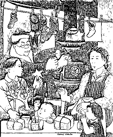
North of Delta the US Government built the Topaz Relocation Site.

Shortly after the attack on Pearl Harbor, the Government relocated and confined here
persons of Japanese descent. From 1942 to 1945 the camp housed approximately 9,000
evacuees. According to the National Register, Topaz symbolizes, the extreme prejudice and
war hysteria following the attack on Pearl Harbor.

In Hinckley, we get the last warning that services are not available for the next 83
miles. Good luck! We have lunch with us, so we can eat in between.
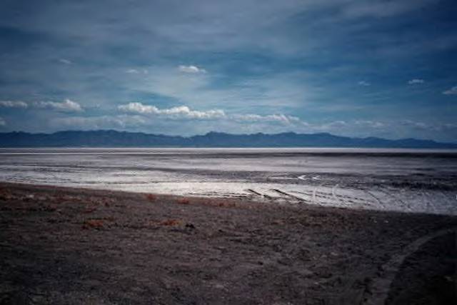
On the left side of the road, we can see Sevier Lake-or what is supposed to be a lake. The
map says it's an intermittent lake. From what I see, it is a very flat plateau where water
accumulates from winter runoffs. We are told that the lake used to have a lot more water,
but most water from the Sevier River is now diverted for agricultural purposes. The
temperature gets very hot and with low humidity, the water evaporates rapidly. On the
north shore, the lake bed is covered with sand that the river water carried into the lake.
We see very little water.

Photo copyright Erika Lockhart
After we cut through Skull Rock Pass, we can see on our right Notch Peak. With an
elevation of 9,725 feet, Notch Peak is the largest limestone formation in the state. The
north side of the peak has a spectacular 3,000 foot cliff.


