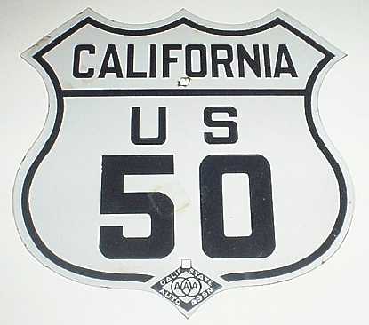
Welcome to California—The Golden State.
The capital is Sacramento. - State motto is "Eureka - I have found it".
On day twenty of the journey we hope to reach our destination. We have
dreamed about seeing the sun set on the Pacific. It now feels like graduation day before
you get your diploma.
We stayed last night in South
Lake Tahoe. One must experience beautiful Lake Tahoe with its towering pine trees.
Just be careful that none of those pine cones falls on your head. The size of the pine
cone can be as large as 10 or 12 inches in length and 7 inches in diameter. They
make beautiful Christmas decorations.
Lake Tahoe is the deepest alpine lake in North America. It lies in this
beautiful valley of the Sierra Nevada among snow-capped mountains at an elevation of 6,228
feet. The lake has a depth of 1,640 feet.
The historic Lincoln
Highway runs from New York to California. In California it followed US 50
from the beautiful south shore of Lake Tahoe to San Francisco.
To leave the Tahoe basin, we must climb up to 7,382 feet and pass over
the Echo Summit. This brings us back in the snow region. The scenery of the Eldorado
National Forest reminds us of Switzerland or Austria, which we have visited on many
occasions. The road is as winding as in those countries. In fact, the eastern slopes
of the Sierra Nevada are nicknamed ‘California Alps.’
The drive from Tahoe to Placerville is a very dignified and a pretty
ending for US 50. It is more a drive through a park than a highway. We have now descended
below 3,000 feet. In early days, Placerville was known as ‘Hangtown.’ Citizens
witnessed law and order of a ‘necktie party’ from the Hangman’s
Tree. Pony Express still Delivers. Historical Re-enactment Gallops through the country. For
more information link to Placerville. Today the town is peacefully surrounded by
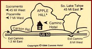
orchards, ranches and vineyards. You may want to check out the Camino
Hotel located 7 miles east from Placerville. Mention Route50.com
and you will receive a special welcome.
As we cross the Sacramento
county line, we can see the skyline of the city in the distant haze. This is the first
skyline we have seen since Kansas City, about 1,500 miles ago. Oh, yes, we saw
skylines—the grain elevators in Kansas—that’s what they called skylines.
We’re coming to the end of Route 50 which has been a faithful
companion to us for the last 20 days. What a journey it was! What a memory we have! It was
a lot of fun. It was very rewarding and interesting.
US 50 enters the Sacramento freeway infrastructure as a proud,
eight-lane highway. It moves traffic for the city of Sacramento. We have located the last
official location with reference to Highway 50. It’s a call box with the reference
of: YL-50-01. It is at the intersection where we merge into Interstate 80 going west to
San Francisco. If you go in the opposite direction, you can see a sign "US 50 Lake
Tahoe." That’s where you can start your travel going east towards Ocean City,
Maryland. It has been a pleasure to drive this road for 3,547 miles. It is a proud road
with a great heritage that crosses many parts of our beautiful land. We feel the same
pride for the experience and joy that this trip has given us. A thank you to all the
people we met and their encouragement.
We now continue on I-80 towards San Francisco, where we will reach the
Pacific and hope to see the sun set in the West. This is the same sun which rose in the
East above the Atlantic many hours before we awoke this morning.
We stop at a very nice rest area just before Vallejo. From here we have a good view of the city
below. Like all cities in California, it is booming, it is a modern city, and its pace is
fast. Time does not stand still in California. Time is running ahead. After a cup of
coffee, we continue on I-80 to Oakland and take the San Francisco-Oakland Bay Bridge into
San Francisco. Makes no difference what time of day you come, traffic is congested.
We can see the Bay Bridge and the skyline of San Francisco in a haze, which gives it a
kind of ghostly effect.
There is a $2 toll to cross the San Francisco-Oakland Bay Bridge. To
collect the tolls, there are 17 toll booths and we form one of 17 queues that serve
traffic from various directions. This is quite a task and quite a show. After we pay
our toll, the 17 lines must merge into five individual lanes. The first merger is done
with the assistance of a computer. After that comes courtesy—one car from the right,
one from the left and one from the center. Ultimately five lanes go across the
bay. It works really well, and a little bit of courtesy goes a long way.
The Bay Bridge is actually two bridges. One goes from Oakland to the
Yerba Buena Island and then from there, another bridge takes you into the city of San Francisco. The city with its famous
landmarks and colorful people has been the subject of many books, photographs and movies.
Do not forget a ride on the trolley. For five dollars one can ride all day across town. It
is the best bargain you can get. A space on the running board gives you a spectacular
view. Be
sure to check out the theater district as well for great performances, musicals and local productions. There are also some great
clubs in this area for those into that type of scene. There are many well-known hotels and timeshare resorts in that part of the city as well
including the Serrano Hotel and The
Donatello, a highly rated resort for longer stays.
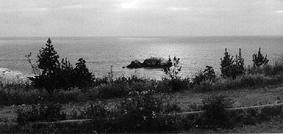
Hooray! We finally have reached the Pacific! The Pacific is in
front of us. We have gone 3,634 miles coast to coast. What an accomplishment, what a
sight. A sight we have eagerly anticipated for 20 days. It is cloudy, but through the
clouds the sun is shining on the Pacific at one spot just for us, to welcome us. We thank
God for giving us a safe drive for almost 4,000 miles.
The point where we reach the Pacific is called Point Lobos. It’s
where the Seal Rocks are located. Sea lions inhabit this place now year-round and amuse
tourists from around the world. The weather is cold, or better, it’s windy today.
Therefore it does feel cold. We go back and put on our winter parkas. What a coincidence!
It was cold when we left the Atlantic at Ocean City. We arrive at the Pacific and it is
almost the same temperature.
The scenery of Highway 1 is just magnificent and there are many places
to stop. We eventually reach Rockaway
Beach, which is a very small beach community.
The Lighthouse Hotel is very beautiful and the rooms are very spacious.
They have a dining room which is very formal overlooking the beach. We opt to eat at a
small Mexican restaurant which sits right in between parts of the Lighthouse Hotel.
The food is just superbly cooked, and the
prices fairly reasonable considering that this is a seashore luxury hotel complex. So, we
have a delicious meal and celebrate this day with a fine bottle of wine.
Good night from the Pacific Ocean.
Thanks to Robert Edgar
in Bakersfield, California
for sending us a photo of the California road sign from his collection.